![]()
Maps of The Foothills in Carlsbad, CA
Satellite Map
Here’s a map of the Foothills subdivision in relation to Carlsbad Schools. Click the icon in the upper left corner to view the map legend.
Street View
The starting point is the roundabout at the Hilltop Street entrance.
Plat Map
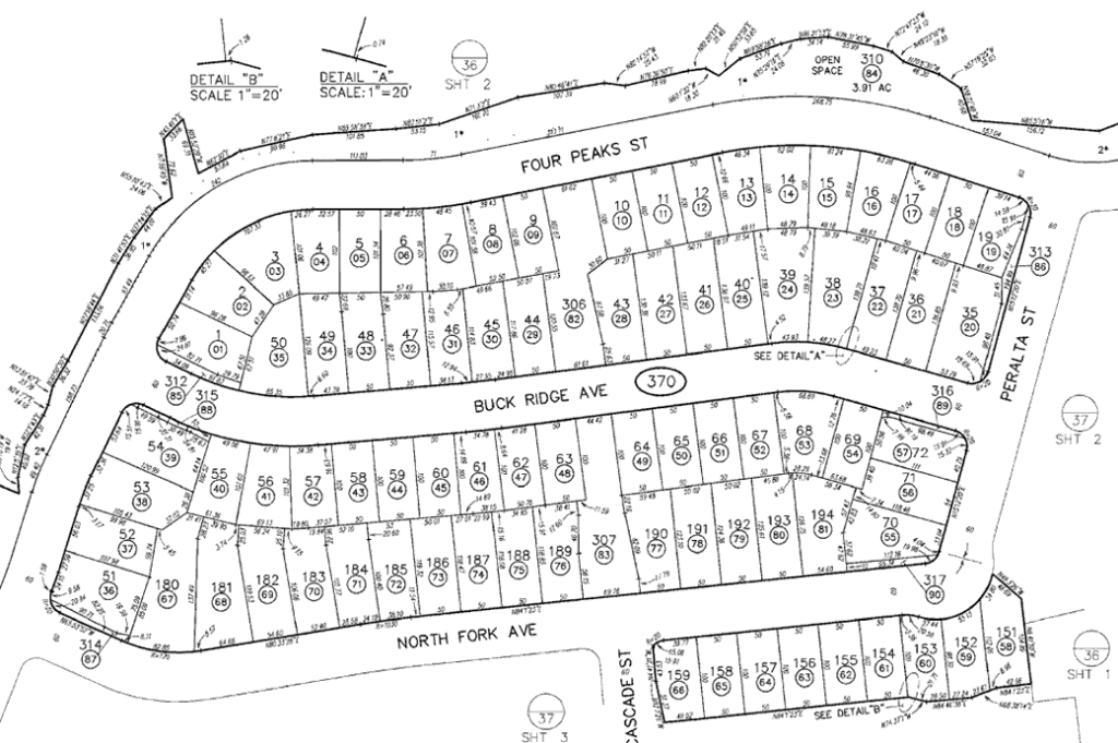
Click the map below to view/download a PDF of the plat map.